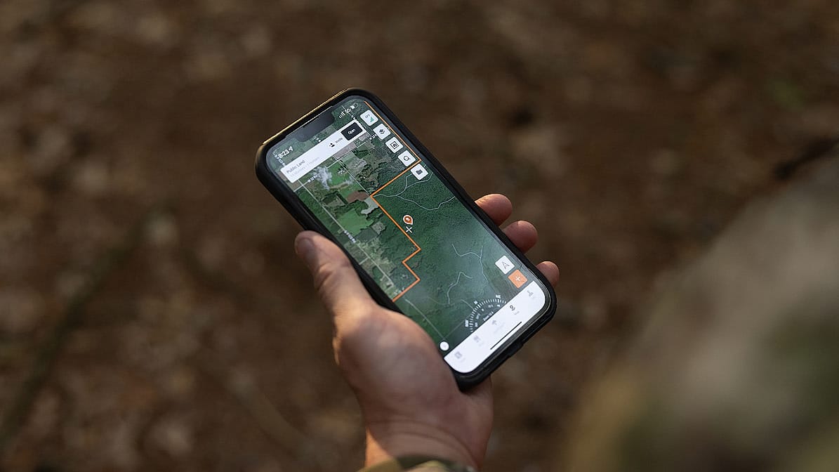
Public Parcels, Locked In
HuntWise helps you find legal hunting ground in seconds. Crystal-clear public land boundaries across all 50 states, with over 650 layers that highlight what matters most.
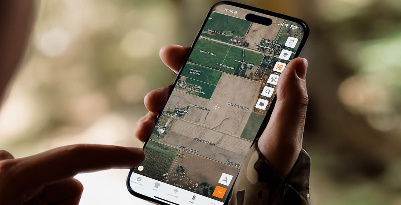
Know Property Lines. Contact Landowners.
Know exactly where private boundaries sit, find acreage information, and landowner contact information with the ultimate property line app. HuntWise turns parcel maps into limitless possibilities.
Turn on the layers that matter—property lines, terrain, trails, and designations—for instant clarity.
Add custom pins for stands, beds, scrapes, cameras, and more. Every detail in one place.
Conditions change, your plan shouldn’t. Overlay wind, weather, and rut data to adapt in real time.
Turn Maps into a Game Plan
Use 650+ map layers, custom pins, and overlays to turn scouting into a proven in-field strategy.


Mark It, Share it, and Check-In
Share what matters: pins, paths, and plans. Keep partners and family updated from one place in the app.
More than a Hunting App, Your In Field Companion
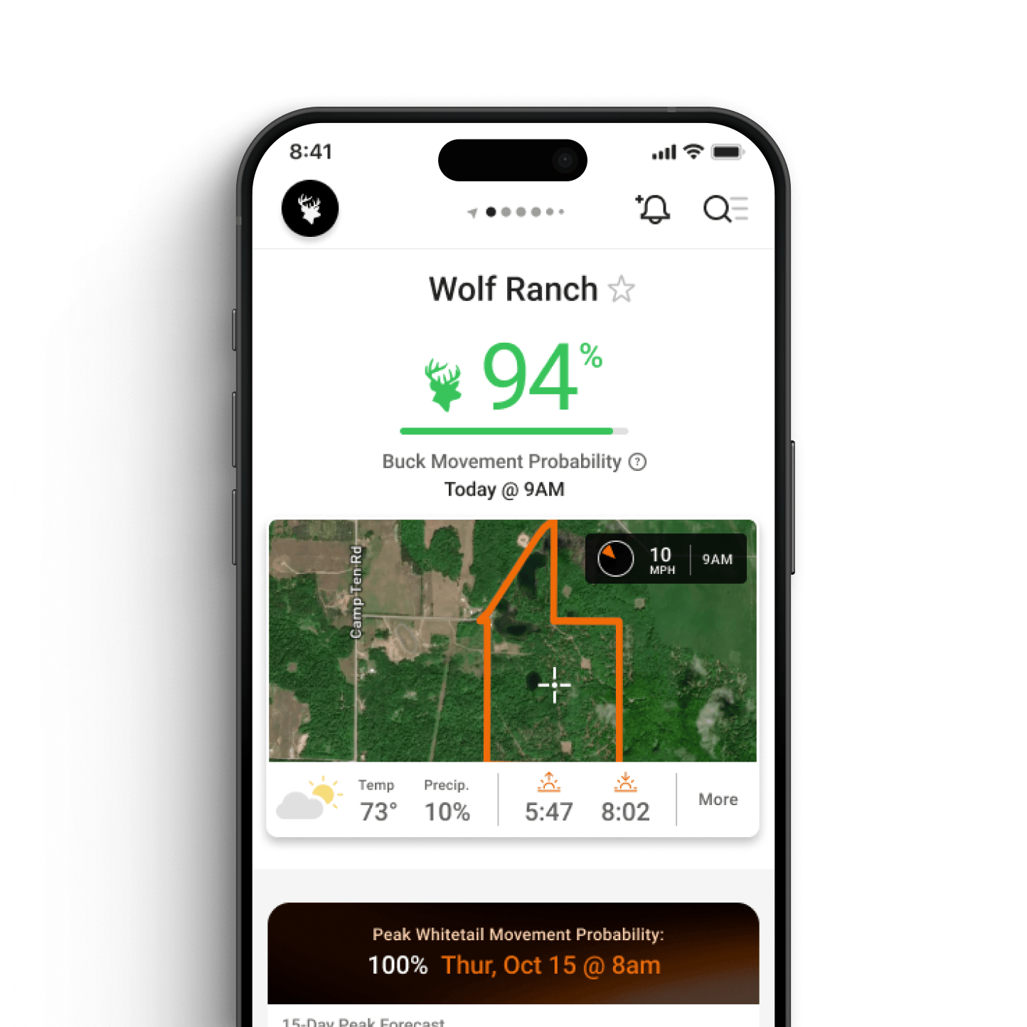
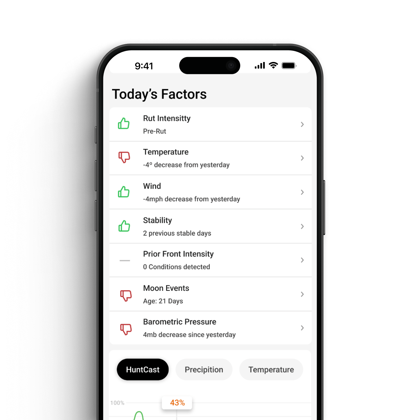
HuntCast
Get forecast to accurately predict animal movement and pinpoint peak rut timing, so every hunt is timed with purpose.
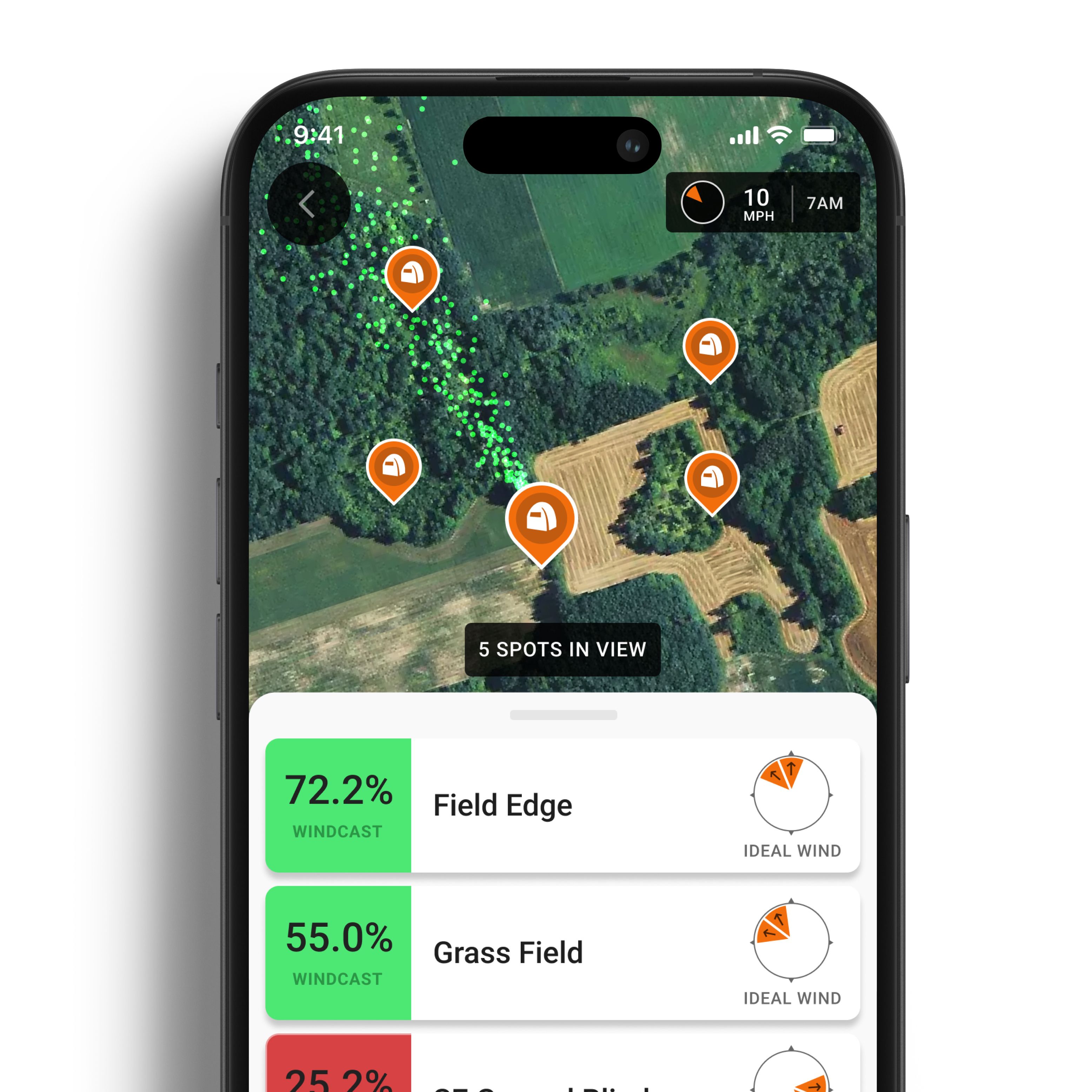
WindCast
Track real-time wind conditions to help keep your scent under control and keep you invisible in the field.
RutCast
Break down every phase of the rut with region-specific insights, so you can time your hunts when whitetails are most active.